
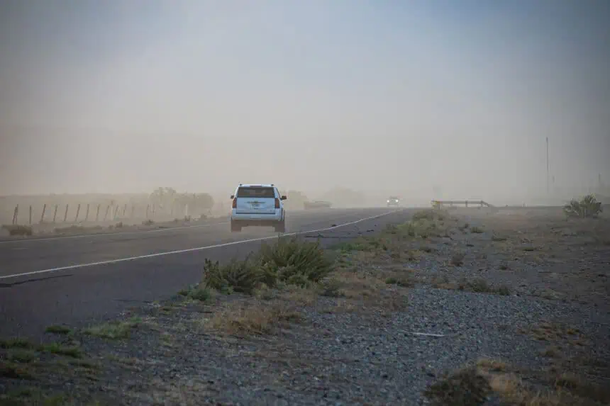

Sunday evening, June 15, a dramatic weather event swept across El Paso, Texas, and Las Cruces, New Mexico—a powerful dust storm known as a haboob, according to the National Weather Service El Paso.
What is a haboob and how it formed on Sunday
A haboob is a severe dust storm generated by outflow winds from thunderstorms. These winds, often strong and sudden, lift large amounts of dust and sand, drastically reducing visibility in a matter of minutes. That’s exactly what occurred around 6:30 p.m. near Horizon City, when the storm began its dramatic journey across El Paso County.
The haboob’s path over Franklin Mountains to Las Cruces
This particular storm advanced swiftly, blanketing the Franklin Mountains before descending into El Paso’s West Side. A remarkable drone panorama captured the moment the wall of dust loomed over the mountain ridge. By sunset, the storm had pushed further into Las Cruces, flowing over the Organ Mountains in a spectacular but hazardous sweep.
Visibility and wind conditions during the event
Visibility plummeted to as low as three-quarters of a mile, and wind gusts surged between 35 and 45 mph. These intense conditions led to a dust advisory that remained active until 8:30 p.m. Sunday evening. Local residents shared images showing the impressive scale of the storm, including one in East El Paso just as the haboob approached.
Meteorological insight from the National Weather Service
The National Weather Service emphasized that haboobs form from thunderstorm outflows that kick up loose soil and sediment, especially in arid regions like West Texas and southern New Mexico. The agency warned that such events can create rapid drops in visibility and pose serious travel hazards.
Stay tuned for further updates on extreme weather conditions affecting the Desert Southwest.


