
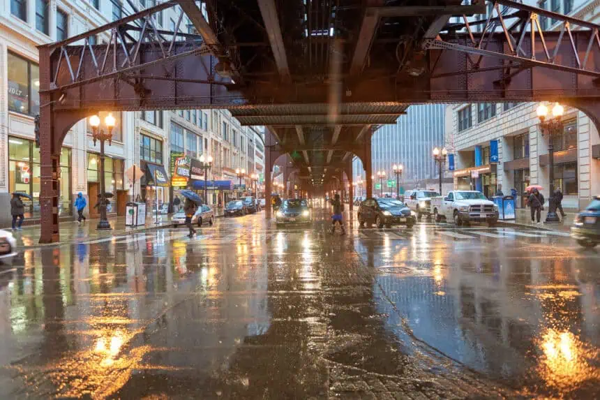

CHICAGO — A violent wave of thunderstorms swept through Chicagoland on Thursday afternoon, leaving behind a trail of damage, from snapped trees and power outages to airport delays and an apparent explosion in Berwyn.
Shortly after 3 p.m., Doppler radar detected intense rainfall, dumping between 1 to 2 inches in just 30 minutes, prompting the National Weather Service to issue urgent flood advisories across Cook, DuPage, and Will Counties. Gusty winds, some clocking above 70 mph (113 km/h), battered the area, including a recorded blast of wind at Midway International Airport at 3:02 p.m.
By evening, ComEd confirmed that nearly 33,000 households were left without electricity. Earlier in the day, outages had peaked at close to 50,000 customers, especially in Will, DuPage, and Kane Counties. In Northwest Indiana, NIPSCO reported around 3,000 customers affected.
In Chicago’s Englewood neighborhood, a massive tree near West 71st Street and South Seeley Avenue was ripped from the ground, damaging three homes. One home sustained a shattered window and a broken awning, while another resident, Vivian Jones, lamented damage to her fence and noted she had previously alerted the city about the tree’s condition.
Over in South Shore, a large limb broke off near East 78th Street and South Exchange Avenue, crashing into the street just feet from Metra tracks. No injuries were reported, but power lines were brought down onto sidewalks, posing serious safety concerns.
A dramatic moment unfolded in Berwyn, where police and fire officials responded to an apparent explosion at a gas station near Ogden Avenue and Oak Park Avenue. Authorities are still investigating whether a lightning strike may have sparked the blaze.
Downed trees also caused major traffic disruptions across South Jeffery Boulevard, the 1600 block of West 52nd Street, and the 8000 block of South Jeffery Boulevard. Some incidents involved trees tangled with power lines, while others blocked entire roadways.
A video shared by Marlene Lopez-Cortez from Lisle, reposted by the Illinois Storm Chasers, showed storm winds tearing through a screened patio, flipping furniture and toppling a cabinet. The footage captured the raw force of the severe gusts.
Both O’Hare and Midway airports experienced temporary ground stops, stranding travelers and delaying flights. At O’Hare, a gust of 64.4 mph (103.6 km/h) was logged, while Gary Chicago International Airport in Indiana reported winds above 63 mph (101.4 km/h).
In Naperville, near Naper Boulevard and Collingwood Drive, trees and wires were knocked down, and in Woodridge, limbs as thick as 6 inches in diameter littered the ground. Meanwhile, in Romeoville, power poles were reported snapped, further straining the electrical grid.
Events weren’t spared either: Algonquin Summer Concerts were canceled due to the storm threat, and heat advisories across Illinois and parts of Indiana were lifted as the system brought temporary relief from the sweltering temperatures that had plagued the region.
The National Weather Service maintained an active stream of Severe Thunderstorm Warnings, Flood Advisories, and even Marine Warnings, extending from Winthrop Harbor to Michigan City, as the storm line advanced eastward at speeds up to 50 mph (80 km/h).
Emergency crews across Berwyn, Kane County, DuPage County, and beyond continued working into the night to assess damage, restore power, and keep roads safe. As of now, residents are urged to treat all downed lines as live and report any hazards to ComEd or emergency services.


