


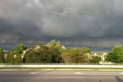
CHICOPEE, Massachusetts – A Severe Thunderstorm Warning is in effect for southeastern Hampden County until 7:30 p.m. Tuesday evening, with threats including damaging wind gusts up to 60 mph, nickel-sized hail, and potential harm to roofs, siding, and trees.
Tuesday unfolded as a humid day with a mix of sun and clouds, bringing scattered showers and thunderstorms across western Massachusetts. A few early morning showers developed before 9:00 a.m., followed by a return of sunshine before noon, lasting into mid-afternoon. Cloud cover returned after 3:00 p.m., setting the stage for potentially strong to severe thunderstorms from 4:00 p.m. through 9:00 p.m.
The most active storm window—with the highest risk of severe weather—was expected between 6:00 p.m. and 8:00 p.m., with conditions favorable for strong winds, localized downpours, and small hail. Temperatures ranged from the mid-80s to low 90s Fahrenheit (about 29°C to 33°C).
Wednesday brings a return to dry and warm conditions across the region, with highs near 90°F (32°C) and mostly sunny skies.
Thursday stays dry and partly sunny during the day, but evening showers and thunderstorms may return, especially after sunset. Temperatures will again rise into the mid to upper 80s°F (around 30°C).
Stay alert to evolving weather conditions across Hampden County and western Massachusetts, especially during the evening commute and any outdoor events.


