

Red alert for Monday and Tuesday in New York
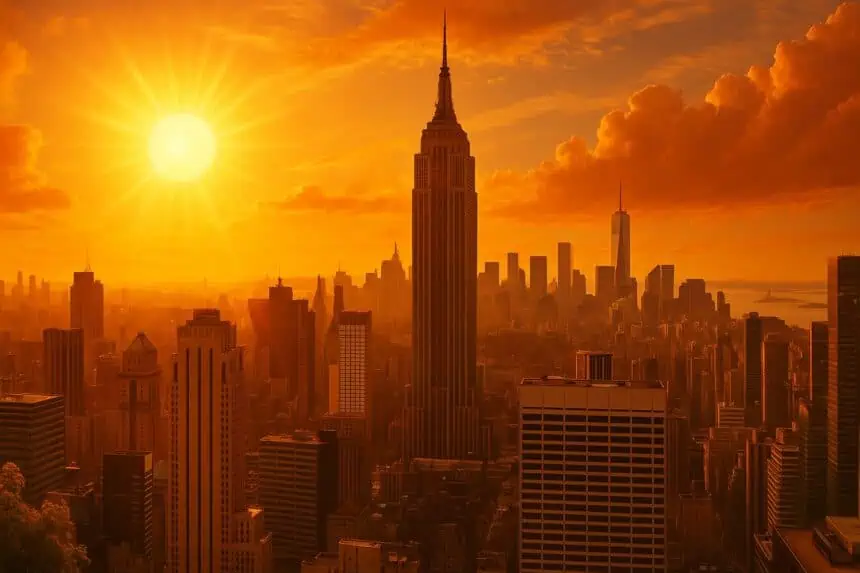
A massive heatwave is set to scorch New York City early next week, with extraordinary temperatures that could rewrite the city’s weather history. Forecast models show a high of 100°F (37.7°C) on Monday, June 23, and a peak of 102°F (38.8°C) on Tuesday, June 24, potentially breaking 137-year-old records.
According to Fox Weather meteorologist Stephanie Van Oppen, it won’t just be the heat—extremely high humidity will make conditions feel even more oppressive. The dew point could rise into the 70s°F (21°C+), creating a heavy, sticky atmosphere. “It’s the kind of air that feels like you’re walking through a swimming pool,” Van Oppen said. “It clings to you, it’s very sweaty.”
Central Park may experience new record highs for both days, topping the 96°F (35.5°C) set on June 23 and 24 of 1888.
Feels-like temperatures could exceed 105°F (40.5°C)
These conditions could push heat index values — which combine temperature and humidity — up to 105°F (40.5°C), creating dangerous conditions for vulnerable groups like older adults, those with health conditions, and anyone spending extended time outdoors.
Heat could affect primary election turnout
The extreme heat may also impact voter turnout during Tuesday’s Democratic mayoral primary, especially among voters over 50, many of whom support former Governor Andrew Cuomo. A recent New York–Siena College poll showed Cuomo leading with 42% of first-choice votes in that demographic.
Weekend warming up toward the peak
The weekend will serve as a warm-up to next week’s extreme heat. Saturday will see partly sunny skies with highs around 88°F (31.1°C), while Sunday is expected to reach 97°F (36.1°C).
Extreme heat warning issued by Governor Hochul
Governor Kathy Hochul has issued an official “extreme heat” alert for much of New York State, calling heat the number one cause of weather-related deaths and urging New Yorkers to get ready for dangerous conditions.


