

Monsoon moisture is drifting steadily closer to southeastern Arizona, signaling a shift in the atmosphere that will bring cooler temperatures and renewed chances for rain in the coming days.
TUCSON, Arizona – In the early hours of this Saturday, June 21, southern Arizona is waking up to noticeably cooler temperatures that are expected to persist through the weekend. This refreshing change is being driven by a surge of monsoon moisture approaching the southeastern corner of the state, nudging its way toward the Tucson metro area.
Before the arrival of this humid monsoonal air, strong afternoon winds are forecast to pick up across southern Arizona, elevating the risk of wildfires—especially in areas already strained by dry vegetation and above-average heat.
Outdoor caution is essential this weekend, particularly when handling flammable materials or any tools that could generate sparks, as gusts may exceed 30 to 40 mph (48 to 64 km/h) in some rural locations.
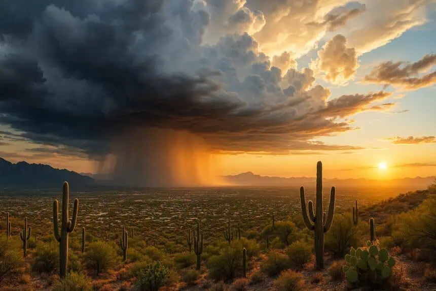
Looking ahead, moisture levels are projected to increase late Sunday, with the most notable surge arriving by Monday afternoon. This shift opens the door to isolated to scattered thunderstorms, which could develop each afternoon and evening through Friday.
In Tucson, the most favorable window for storm activity appears to be Tuesday, when conditions align for potentially heavier downpours, brief wind gusts, and localized lightning. Daytime highs will dip slightly with the increased humidity, settling in the upper 90s°F (36–37°C) range, and potentially falling further during active storm periods.
The return of the monsoon pattern brings with it much-needed relief from persistent dry conditions across the Desert Southwest, marking what could be the beginning of a more active late-June weather pattern for Arizona.


