

 Dangerous thunderstorms expected across Central and Southern Minnesota
 Dangerous thunderstorms expected across Central and Southern Minnesota
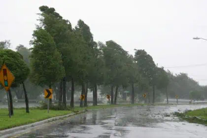
This afternoon and evening, Tuesday, June 17, a volatile weather setup is taking shape across Central and Southern Minnesota and Northern Iowa. According to meteorologist Shawn Cable, severe thunderstorms are forecast to develop after 3:00 or 4:00 PM CDT, bringing the potential for very large hail, isolated tornadoes, and intense rainfall.
Timing and threats: What to expect
Storm development will begin by mid to late afternoon, with initial supercell activity possibly producing damaging hail over 1.5 inches in diameter, along with the chance for a brief tornado in open terrain. These discrete cells will eventually merge into a linear complex that will sweep eastward, affecting communities until around 10:00 PM.
Areas already saturated from previous rounds of rainfall over the past few days will be particularly vulnerable. Additional rainfall from today’s storms could lead to localized flash flooding, especially where drainage remains poor.
Further storm rounds Tuesday night into Wednesday
Another round of thunderstorms is expected to develop late tonight, continuing through Tuesday night, particularly along and south of I-90 and across most of Iowa. This next wave could drop multiple inches of rain, compounding flood risks in already soaked regions. Residents in southeastern Minnesota and northern Iowa should prepare for more widespread heavy rainfall and possible storm-related damage overnight.
NOAA weather radio outage a critical concern
A key warning system will be unavailable for parts of Central and Southern Minnesota. NOAA weather radio stations maintained by the National Weather Service Twin Cities are undergoing a system upgrade, and service will be down until Wednesday. This means NO automatic weather alerts will be broadcast through weather radios during today’s severe weather event.
The public is urged to rely on alternate alert systems such as local TV, the KEYC First Alert Weather App, or mobile emergency alerts to stay informed.
The First Alert team is on standby
The KEYC First Alert weather team remains fully activated, tracking this rapidly evolving threat minute by minute. Live updates will be available throughout the day on broadcast, the First Alert app, and official social media channels as the situation unfolds. Stay vigilant if you’re located between Mankato, Albert Lea, Austin, or Mason City, where some of the strongest storms are likely to pass.


