
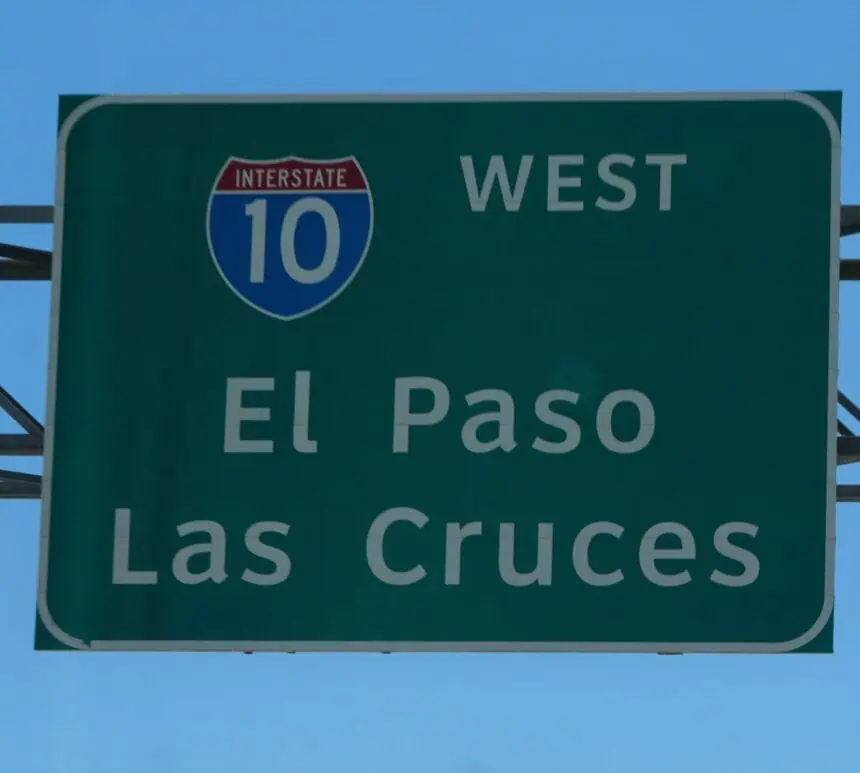

On Sunday evening, June 15, a powerful dust storm swept through El Paso and Las Cruces, taking the form of a dramatic weather phenomenon known as a haboob, according to the National Weather Service in El Paso.
What a haboob is and how it formed
A haboob is an intense dust storm triggered by thunderstorm outflow winds, which can lift massive amounts of dust and sand into the air, sharply reducing visibility and transforming landscapes within minutes.
This storm entered El Paso County near Horizon City around 6:30 p.m. local time, then surged westward across the Franklin Mountains, swept through the Upper Valley, and finally reached Las Cruces, cresting the Organ Mountains just before sunset.
Impact on visibility and wind
Visibility during the storm dropped to as low as three-quarters of a mile, with wind gusts reaching 35 to 45 mph (56 to 72 km/h). These conditions created extremely hazardous situations for travelers and residents in exposed areas.
The National Weather Service issued a dust advisory that remained in effect through 8:30 p.m., urging caution for those in the storm’s path.
Stunning visuals of the event
A spectacular aerial panorama, captured by drone and shared by Ray Chiarello, shows the wall of dust crossing the Franklin Mountains, just minutes before blanketing El Paso’s West Side.
Another image, taken by Elsa Contreras in East El Paso, captures the striking approach of the dust front as it rolled into the city.
Why it happens
According to the National Weather Service, haboobs occur when strong winds from thunderstorm downdrafts sweep across dry, dusty terrain, lifting sediment into the air. This results in a dense, fast-moving wall of dust that can travel for miles in a short period.
Due to their location in the arid Southwest United States, El Paso and Las Cruces are especially vulnerable to these events during the hotter months.


