


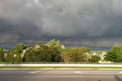
Scattered storms flare again across Kansas overnight
After a wet Saturday morning, most of Kansas dried out by the evening, but new storm development is already underway. Two primary zones are under watch. The first is northwest Kansas, where energy pushing in from Colorado is igniting thunderstorms. The second is southcentral Kansas, where scattered storms are flaring after sunset, adding to today’s already impressive rainfall totals across the Sunflower State.
A Slight Risk for severe weather remains active in both regions overnight, with the rest of the state under a Marginal Risk. The main threats tonight include gusty winds and hail, particularly in isolated pockets as storms evolve toward early morning.
Widespread rain by sunrise across southcentral and southeastern Kansas
By sunrise on Sunday, showers and thunderstorms will expand across southcentral and southeastern Kansas, mimicking the early morning downpours seen on Saturday. Rain will once again taper off into the afternoon, but not before bringing another dose of heavy rainfall.
Temperatures will reflect this rain-cooled air, with central Kansas struggling to climb past the mid to upper 80s°F (29–31°C). Meanwhile, western Kansas, away from the morning moisture, will warm into the low 90s°F (32–34°C).
Storms return Sunday evening with more severe potential
As Father’s Day evening approaches, yet another round of storms is expected, particularly across northwest Kansas. A Slight Risk is in place again, with potential for strong wind gusts and large hail.
A line of storms will form over eastern Colorado and move into Kansas by late Sunday night, likely breaking apart into clusters by the time it reaches central Kansas early Monday morning.
Stormy overnight pattern holds into early week
The state remains locked in an unsettled, nocturnal storm cycle, with late evening storm development followed by morning clearance through at least Monday. While Monday morning storms could flirt with severe criteria, the state only holds a Marginal Risk.
Drying out and heating up for the official start of summer
By midweek, Kansas begins to dry out and temperatures climb rapidly, pushing well beyond average highs just in time for the official start of summer on Friday. Expect increasing heat, breezes, and a more stable atmosphere across most of the region.
Wichita area detailed forecast
Tonight: Partly to mostly cloudy, with a 50% chance of showers and thunderstorms. Low near 69°F (21°C). Winds from the southeast to east at 8–18 mph.
Sunday: Mostly to partly cloudy, with a 40% chance of showers and storms during the morning hours. High near 85°F (29°C). Winds from the east to southeast at 8–18 mph.
Sunday Night: Partly to mostly cloudy, with a 30% chance of storms late evening into overnight. Low around 68°F (20°C). Winds from the southeast to south at 5–15 mph.
Wichita weekly outlook
Monday: High 91°F (33°C), Low 72°F (22°C). Partly cloudy and breezy, with a 10% chance of storms in the morning.
Tuesday: High 94°F (34°C), Low 70°F (21°C). Windy, with skies partly to mostly cloudy, and a 20% chance of late-day thunderstorms.
Wednesday: High 90°F (32°C), Low 68°F (20°C). Mostly to partly cloudy, with a 10% chance of isolated storms.
Thursday: High 93°F (34°C), Low 72°F (22°C). Partly cloudy and breezy.
Friday: High 95°F (35°C), Low 74°F (23°C). Partly cloudy with strong south winds.
Saturday: High 94°F (34°C), Low 73°F (23°C). Mostly sunny, with gusty winds returning.


