

First Alert Day for Wednesday evening across southern Wisconsin
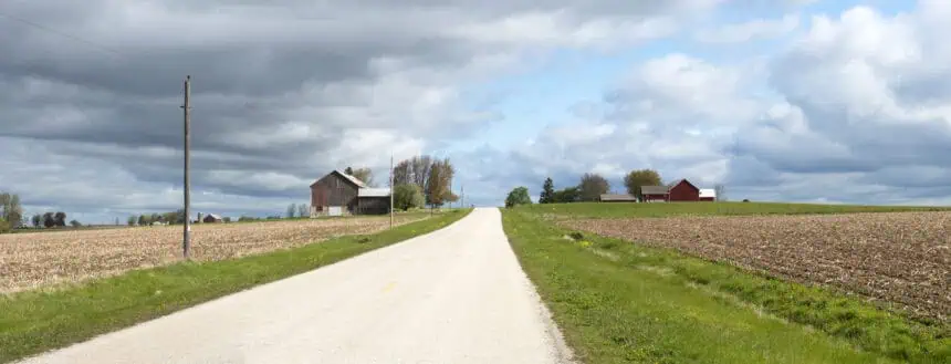
Wednesday, June 11, 2025 — MADISON, Wisconsin – A First Alert Day is in effect tonight for southern Wisconsin, where strong to severe storms are expected as a cold front pushes through the region. These storms are likely to arrive in waves, beginning in the late evening and continuing into the early hours of Thursday. Scattered showers, gusty winds up to 50 mph (80 km/h), and hail are possible, especially in open rural areas and along Highway 151.
The storms will not affect every location at once, but localized intense downpours could reduce visibility quickly for evening drivers. If you plan to be outdoors in the Madison area, keep a rain jacket or umbrella handy, and be prepared for sudden changes in weather conditions.
Rainy Thursday morning with potential lingering thunderstorms
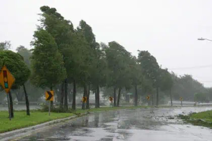
By Thursday morning, showers and embedded storms may still be impacting commutes around Dane County, especially near Sun Prairie, Verona, and Middleton. Wet road conditions will likely slow traffic on Interstate 39/90 and Highway 12. The cold front causing this instability is forecast to stall across central Wisconsin, which could lead to intermittent showers and isolated storms through the afternoon.
The placement of this front will be critical — even a slight shift north or south could dramatically affect who gets more rainfall versus who stays relatively dry. Areas along the Wisconsin Dells to Fond du Lac corridor are particularly sensitive to these variations.
Friday may bring a final wave of activity before clearing
By Friday afternoon and evening, the low-pressure system driving this event should begin shifting toward Michigan. However, southern Wisconsin, including Janesville, Watertown, and Beaver Dam, may still be close enough to see spotty showers or a rumble of thunder, especially late Friday night. The heaviest rain will likely move further north and east, targeting Green Bay and northern Door County.
Saturday and Sunday: gradually improving weather for Father’s Day weekend
Saturday will still carry the chance of light, scattered rain, especially in south-central Wisconsin, but showers should become weaker and more sporadic. Many towns may experience dry breaks, particularly by late afternoon. The trend continues into Sunday, when high pressure from the northeast moves in, bringing cooler temperatures, lower humidity, and calmer conditions — ideal for Father’s Day activities across southern and southeastern Wisconsin.
Looking ahead to next week: warmer with possible new storm system
Forecast models suggest that early next week will see a gradual warming trend, with temperatures rising into the mid-70s to low 80s °F (24–28 °C). However, another storm system could be close behind by Tuesday or Wednesday, potentially bringing renewed rain chances to western and central Wisconsin, especially areas west of La Crosse and near the Mississippi River Valley.


