


Stormy Tuesday continues across central and southern Georgia
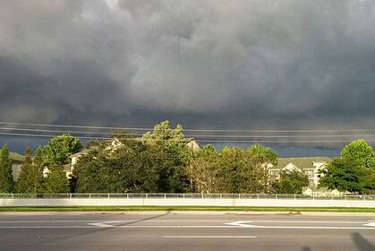
Tuesday, May 27, brought another volatile weather day to Georgia, as a second wave of severe storms swept across the region. By the late afternoon, the most intense storms had moved south of metro Atlanta, but dangerous conditions lingered throughout central Georgia.
As of 5:00 p.m. EDT, the FOX 5 Storm Team confirmed that the severe weather threat had shifted south of Interstate 20, with strong thunderstorms impacting areas like Butts, Jasper, and Monroe counties. Heavy rainfall moved steadily toward Monticello and Forsyth, while a Severe Thunderstorm Watch was lifted in many northern and central counties as the atmosphere began to stabilize.
Tornado concerns earlier in the afternoon
Earlier, the afternoon was marked by severe weather warnings, including a Tornado Warning for Fayette and Coweta counties, encompassing Peachtree City, Fayetteville, and Tyrone, which remained active until 3:45 p.m. There were also reports of tornado spin-ups in Carroll, Coweta, and Fayette counties, though official confirmation is still pending. Damage assessments are currently underway in those areas.
Severe Thunderstorm Warnings also blanketed Carroll, Douglas, Fulton, Paulding, Heard, and Haralson counties from early to mid-afternoon, with damaging wind gusts and heavy rainfall reported.
Temperature contrast and weather dynamics
A strong temperature gradient defined the day’s weather setup. North Georgia, including Canton and Gainesville, remained under the influence of stable, cool air, with temperatures only reaching the 50s°F (10–15°C) and skies remaining cloudy and breezy. In contrast, southern areas, such as LaGrange, climbed to nearly 80°F (27°C)—fostering greater storm intensity.
Airport delays and traffic issues
At Hartsfield-Jackson Atlanta International Airport, a ground stop was implemented early in the afternoon due to storms. Although lifted by 6:00 p.m., a ground delay persisted until 8:59 p.m., according to FAA reports. The severe weather also caused multiple traffic accidents, especially during the morning commute, with incidents reported on I-75 near Highway 92 and I-20EB before Lowery Boulevard.
Evening weather and overnight fog threat
As storms taper off into the evening, patchy fog is expected to develop across metro Atlanta and north Georgia. With soaked roads and reduced visibility, drivers are urged to stay alert. Showers may persist intermittently, but conditions are gradually improving in the northern half of the state.
Outlook through the week
The forecast calls for isolated to scattered thunderstorms from Tuesday through Friday, with each day posing a risk of strong winds, hail, and downpours. For Wednesday, there’s a 40% chance of rain, and temperatures are expected to remain in the mid 70s°F (24°C) for Atlanta, with cooler conditions northeast and warmer temperatures near LaGrange and Meriwether County.
As June approaches, forecasters suggest drier conditions may return by the weekend—a welcome shift after a wet and turbulent start to the week across Georgia.


