
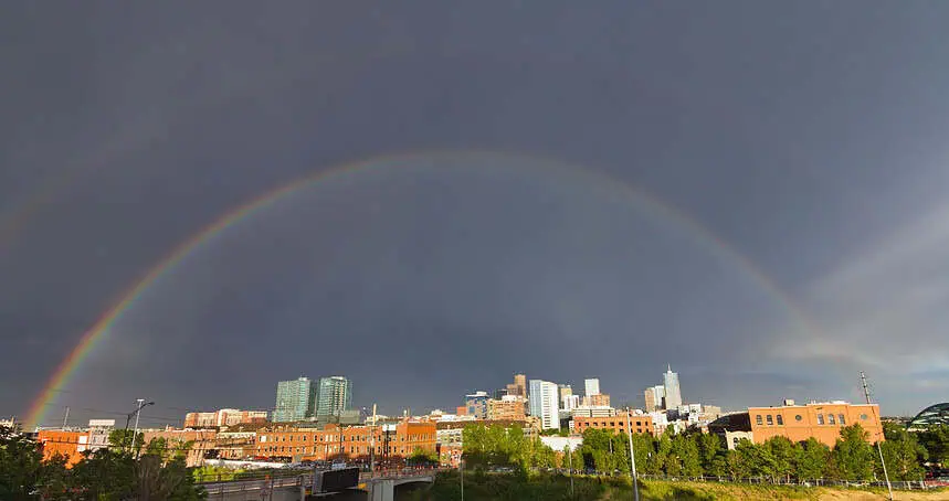

Heavy rain persists across Denver, but tapering begins midday
Denver is waking up to another gray and damp morning as showers continue to move through the city and surrounding areas. Through Tuesday night, steady rainfall soaked the I-25 corridor, and meteorologists expect these showers to gradually ease by midday Wednesday. Rainfall totals in the Denver metro are estimated between 0.5 and 1.5 inches, with diminishing amounts further northeast across the Colorado Plains.
Denver7 Chief Meteorologist Lisa Hidalgo emphasized that Tuesday was the coolest and wettest day of the week, with some slushy precipitation possible on the Palmer Divide. Though no urban flooding is expected, the rain has certainly left slick roads and reduced visibility during the morning commute.
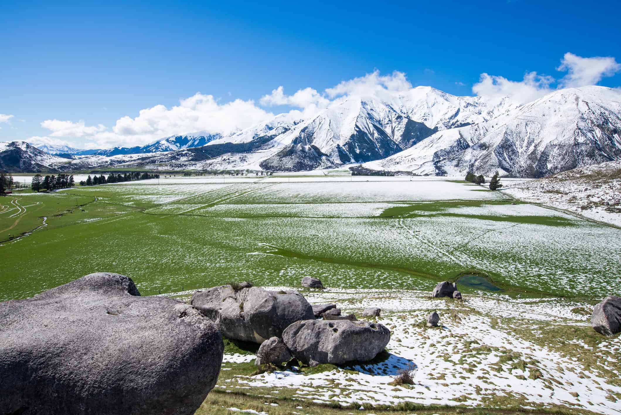
Snowstorm intensifies across the high country
As rain falls at lower elevations, Colorado’s mountains are getting buried under snow. A robust spring storm system is bringing significant snow accumulations to elevations above 9,000 feet, where 10 to 20 inches are expected through early Wednesday morning.
The National Weather Service in Boulder has issued winter storm warnings for the higher terrain in Jackson, Larimer, Grand, Boulder, Gilpin, Clear Creek, Summit, and Park Counties, valid until 6:00 a.m. Wednesday. Affected routes include I-70 east of the Eisenhower Tunnel, Berthoud Pass (US40), Kenosha Pass, and the Peak to Peak Highway. Conditions are hazardous, and travel disruptions are likely.
A winter weather advisory is also in effect for the northern and southern Front Range foothills, where snow totals could reach 10 inches above 8,000 feet. This includes areas like Red Feather Lakes, Estes Park, Georgetown, Bailey, Nederland, and Idaho Springs.
When the skies begin to clear
Rain in Denver is expected to taper off by midday Wednesday, with only spotty showers and isolated thunderstorms remaining for the afternoon hours. Temperatures will remain cool, with a forecast high near 57°F (14°C). The overnight chill and cloud cover will keep things damp but manageable across the metro.
By Thursday, expect a notable warm-up: highs will climb to 68°F (20°C) under mostly sunny skies, with a continued warming trend into the weekend. Friday’s high is forecast to reach 75°F (24°C), with only a few isolated afternoon storms possible.
Looking ahead: warmer and drier trend next week
As we look toward the weekend, temperatures in Denver will rise sharply, with highs reaching the upper 70s on Saturday and topping out around 82°F (28°C) on Sunday. The 10-day outlook suggests above-average warmth and a drying pattern developing across the Front Range, signaling a possible end to the soggy start of May.
Denver’s snow season remains below average
According to official NWS statistics, April 2025 ranked as Denver’s 12th driest on record, receiving just 2.2 inches (5.6 cm) of snow, which is 4 inches below normal. Rainfall was also significantly deficient, with only 0.5 inches (1.27 cm) recorded — a shortfall of 1.18 inches.
As of late April, Denver’s cumulative snowfall for the 2024–25 season stood at 47.7 inches (121.2 cm), which is 7.2 inches below the seasonal norm of 54.9 inches (139.4 cm). While May averages only 1.7 inches (4.3 cm) of snow, there’s still a slight chance for one last late-season flurry, though the current pattern favors warmer, drier conditions through mid-May.


